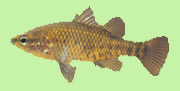
Home What we do Calendar Yarra Pygmy Perch Our History FAQ Resources Things to see Photo Gallery Contact Us


header
Yarra Pygmy Perch
Vulnerable & Threatened


logo


header


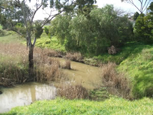
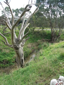
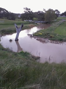
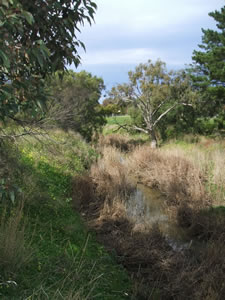
Waurn Ponds Creek rises on the slopes of Mt Moriac and flows eastwards for 20kms through agriculture and urban land until it joins the Barwon river in the marshes at the southern end of Belmont common.

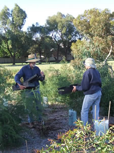
The Friends of Waurn Ponds Creek has been an active group of community volunteers since 2002.

'Friends' takes care of the picturesque corridor through the urban environment of Waurn Ponds, Grovedale and Belmont to create a natural habitat for its flora and fauna. This corridor is also used by people of all ages for recreational purposes.


Our Creek


working


Some facts about the Creek:
   
* Waurn Ponds Creek drains the southern slopes of the Barrabool Hills and is an important part of the
      wider Barwon River catchment.
   * The creek was first surveyed in the 1840s and was called Chain of Ponds because it contracts into
      permanent pools in dry weather.
   * The creek flows through the low-lying Marshall Plains and drains the surrounding flood plain.
   * In 1977 the Valley Parklands were set aside for open space.
   * Waurn Ponds Creek is one of the last places zoned for open space in the fast growing Grovedale to
      Waurn Ponds suburbs.
   * City of Greater Geelong conducted an Open Space Study to look at the needs of the area for open space
      and recreation.  They found that the creek should be p   reserved as a linear corridor for future
      generations to enjoy.
   * Hundreds of people use the creek every day for general recreation.
   * A heritage listed sandstone and bluestone bridge crosses the creek at Colac Road.
creek
creek


creek


creek map


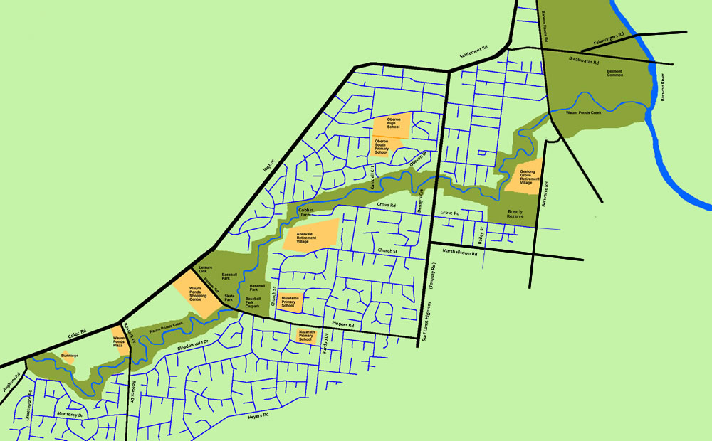
A map of the section of the Creek that we plant and maintenence.

A larger map is available here.

creek